Snow for higher hills
Published 29 October 2026 by SIMA Forecasting Team. All SIMA News articles.
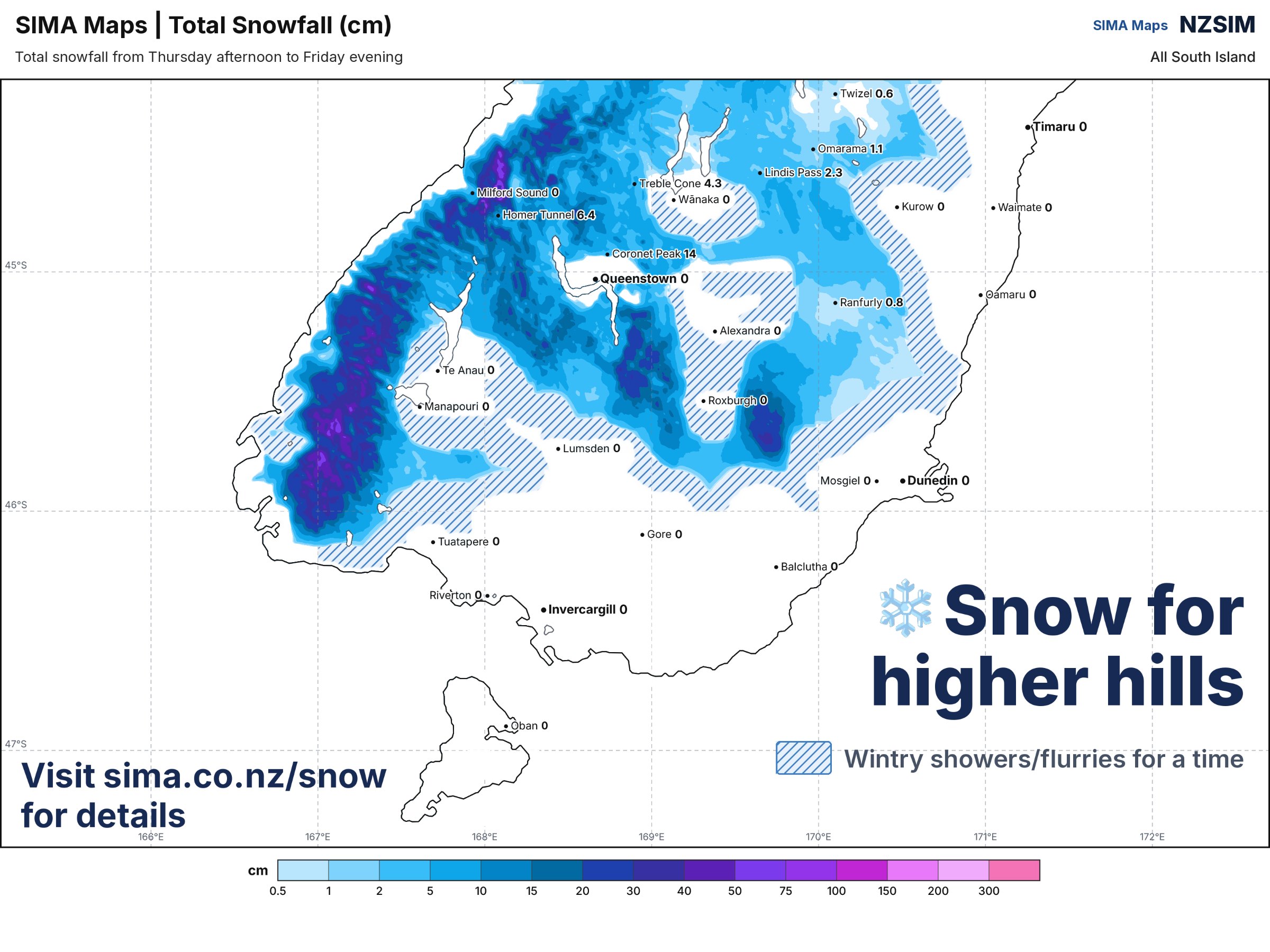
FORECAST UPDATE Snow for higher hills Southland and Fiordland are the ones to keep an eye on as we head into tomorrow. A cool southwesterly flow is sitting over the lower South Island, and with colder air arriving on Fri
FORECAST UPDATE
Snow for higher hills
Southland and Fiordland are the ones to keep an eye on as we head into tomorrow. A cool southwesterly flow is sitting over the lower South Island, and with colder air arriving on Friday there's the chance of snow getting down to fairly low levels.
That's not a one-region story either. The same flow reaches up through the Southern Lakes and Central Otago, into the Mackenzie District, and across the Canterbury high country, so the higher hills and ranges through all of that southern and inland stretch can expect a wintry look about them by Friday.
WHAT'S DRIVING IT
Nothing dramatic in the set-up, just cold air riding in on a southwest flow and parking over the bottom of the island. When the airmass is this cool, the snow level drops well below where you'd normally expect it for late October, which is why low-level snow is on the table rather than just a dusting on the tops.
Thursday is the milder half of the story. The cooler air really shows its hand on Friday.
WHAT IT MEANS FOR YOU
If you're travelling through the inland south or over any of the higher routes on Friday, pack for winter and give yourself extra time. Spring snow tends to be heavy and wet, and it can come and go quickly as the airmass shifts about.
We'll keep an eye on how far down the snow level actually gets and update if the picture changes. See SnowCast forecasts, CLICK HERE.
- South Island Met Agency
South Island Met Agency is an independent private forecaster and does not issue official government severe weather warnings. For official New Zealand watches and warnings, visit MetService.