Cold Air returns; potential high country snow down south
Published 27 October 2026 by SIMA Forecasting Team. All SIMA News articles.
Cold Air returns; potential high country snow down south A cooler (and depending on where you are across the South Island down right wintry) airflow is setting up across the lower South Island from late Wednesday evening
Cold Air returns; potential high country snow down south
A cooler (and depending on where you are across the South Island down right wintry) airflow is setting up across the lower South Island from late Wednesday evening through much of the remainder of the working week ushering in showers down south and along the West Coast.
As seen in the image above, it is going to feel pretty cold around midday Thursday with a gusty southwesterly and cool temperatures, in the single digits for some places.
⚠ SnowCast Forecast Issued
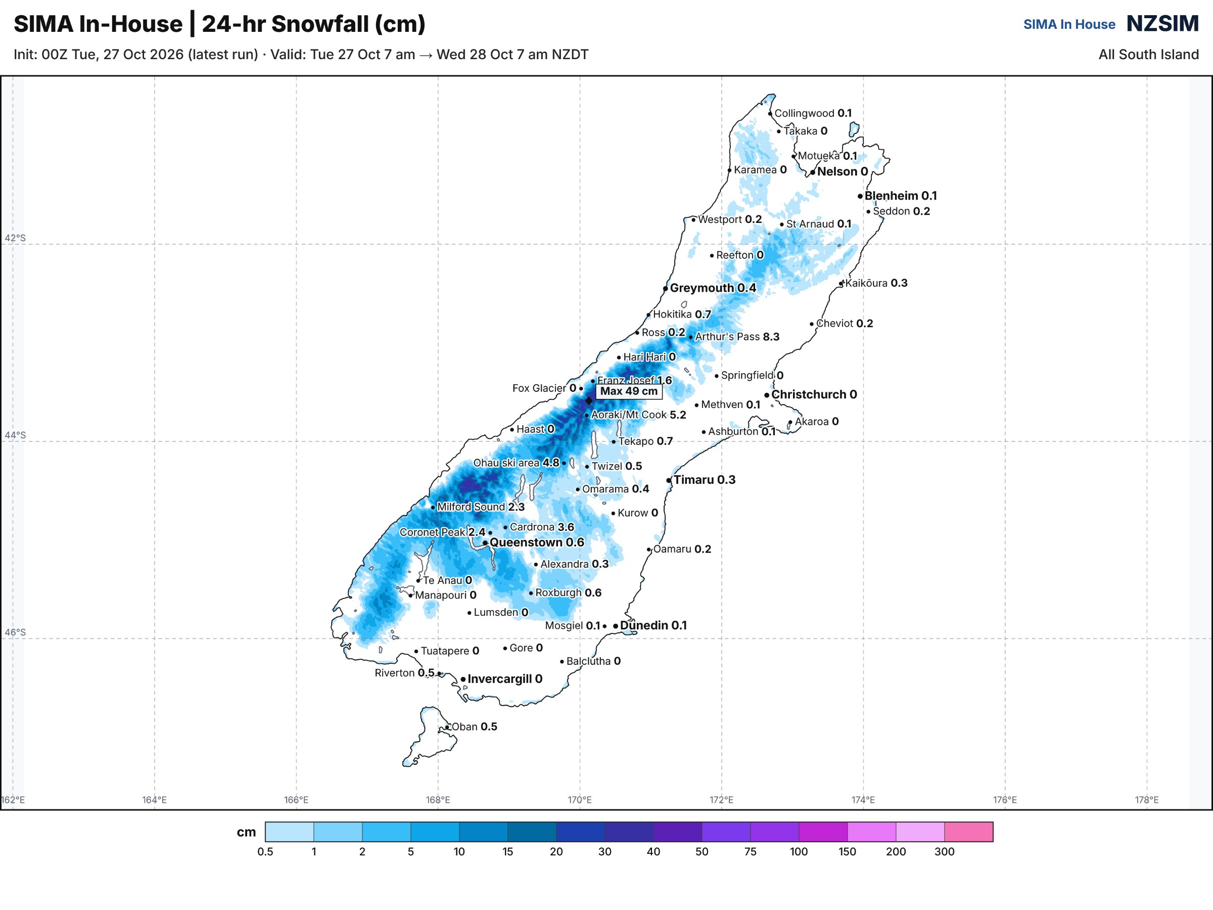
We have issued SnowCast forecasts for Southland, Fiordland and Southern Lakes where snow is possible above 700 metres from early Thursday morning. CLICK HERE TO SEE SNOWCAST
We are keeping a close eye on new model developments, with the potential for a trough overnight Thursday and into Friday morning potentially bringing a risk for more widespread and heavier showers down south and lower level snowfall. Significant uncertainty does remain.
Below is a map of expected snow from Thursday morning til around midnight Thursday.
- South Island Met Agency
South Island Met Agency is an independent private forecaster and does not issue official government severe weather warnings. For official New Zealand watches and warnings, visit MetService.